Croatia’s national map of maritime habitats launched
- by croatiaweek
- in News
Croatia’s national map of maritime habitats launched
Croatia achieved a significant milestone with the successful launch of the National Map of Maritime Habitats at the Institute of Oceanography and Fisheries in Split.
This marked the culmination of the project “Mapping Coastal and Submarine Habitats in the Adriatic Sea under National Jurisdiction,” spearheaded by the Ministry of Economy and Sustainable Development of the Republic of Croatia (MINGOR) in collaboration with a consortium of over 200 experts.
Institute of Oceanography and Fisheries said that the project aimed to enhance knowledge and data accessibility regarding biodiversity, serving as a foundation for the effective protection of the Adriatic ecosystem and sustainable utilisation of natural resources.
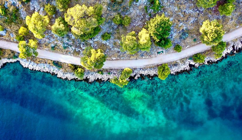
The newly launched National Map of Maritime Habitats stands as a crucial tool for sustainable marine resource management and comprehensive maritime spatial planning, encompassing fisheries and tourism.
The complex project required a multidisciplinary approach, bringing together experts in oceanography, geology, ecology, advanced robotics, and artificial intelligence.
Key collaborators included the Institute of Oceanography and Fisheries, OIKON Ltd. – Institute of Applied Ecology, Croatian Geological Institute, Faculty of Geodesy at the University of Zagreb, and the Ruđer Bošković Institute, in collaboration with the Croatian Hydrographic Institute and companies ECOTECH Ltd, SCIOM Ltd, and DVOKUT – ECRO Ltd.
The Director of the Institute of Oceanography and Fisheries, Dr. Živana Ninčević Gladan, expressed pride in the team’s achievements, emphasising the importance of a multidisciplinary approach. Dr. Aljoša Duplić, Director of the Environmental Protection and Nature Conservation Department at MINGOR, highlighted the project’s significance in proper management and protection of the Adriatic Sea.
The project’s complexity and vital role in the future of the Adriatic Sea were underscored by Dr. Aljoša Duplić, noting that the detailed map covers 51% of the Adriatic, providing crucial data for intelligent, sustainable resource use and planning for economic development. He also mentioned plans to map the remaining 49% of the Croatian part of the Adriatic in the future.
Representing the project implementers, Dalibor Hatić from OIKON Ltd. stressed the importance of technological progress and multidisciplinarity in this endeavor. The project involved extensive mapping, covering depths up to 40 meters, protected areas, and Natura 2000 sites, utilizing diverse methods such as acoustic and remote surveys, direct observations, and modeling.
Dr. Ante Žuljević, leading the mapping activities, detailed the comprehensive approach, involving over 6,500 km² of direct mapping and the application of neural network models based on sediment samples and fishing expedition data. The mapping, covering 18% directly observed and 82% modeled areas, utilized advanced technologies like pull cameras and satellite imagery.
Despite the complexity and extensive fieldwork, the project was completed within the set timelines, showcasing the dedication and efficiency of the collaborative effort.
The total project cost amounted to 11.9 million EUR, with 85% EU co-financing and national co-financing from the Environmental Protection and Energy Efficiency Fund. The successful completion of this project not only benefits Croatia but also contributes valuable insights to the international scientific community.
You can see the map here.